SpaceNews
Edgybees Featured
By Sandra Erwin
Ken Campbell, a former director of national security engagement at Maxar Technologies, now runs the U.S. arm of Israel-based Edgybees.
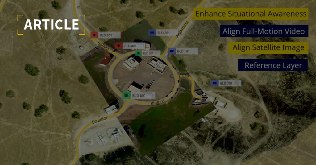
Commercial and government organizations use Edgybees’ software to georeference satellite images and other data.
Georeferencing means adding geographic information to an image to verify the location of an object of interest. Campbell said that Edgybees takes a raw image and aligns it with its exact position on Earth.
Edgybees’ goal to penetrate the U.S. defense and intelligence market led the company to establish a domestic presence, and recently announced appointments to its U.S. board of directors, Campbell said.
Campbell added that establishing relationships with U.S. government agencies and prime contractors requires a physical presence where decisions are made and contracts are awarded. That’s not possible “if you’re thousands of miles away.”
“First, you send white papers and respond to requests for proposals,” he said. “But the final effort comes from personal interaction either with the prime contractors or directly with the customer. It’s hard to do that over a Zoom conference.”
In the geospatial intelligence sector of the market where Edgybees competes, sometimes customers require company engineers and software developers to work at government locations, “so you have to have people in the U.S. to meet those needs,” Campbell said.
Some agencies in the U.S. government have become increasingly open to working with foreign firms, he said. “They understand that when you have a ‘not built here’ mentality, you limit yourself, and there’s a lot of great technology that’s being built by overseas companies.”
Campbell said DoD and the intelligence community can greatly benefit from the democratization of space. Space companies outside the United States are developing capabilities at increasingly lower prices, “and they have an opportunity to inject themselves into the competitive process,” he added. “You’re seeing this with SAR [synthetic aperture radar] satellite imaging in particular, and other forms of remote sensing.”