Do you rely on motion or satellite imagery to support critical decisions?
If you do, you need Edgybees.
Edgybees serves commercial and government organizations as well as the ecosystem partners that support them.
Defense and Intelligence Operators & Analysts
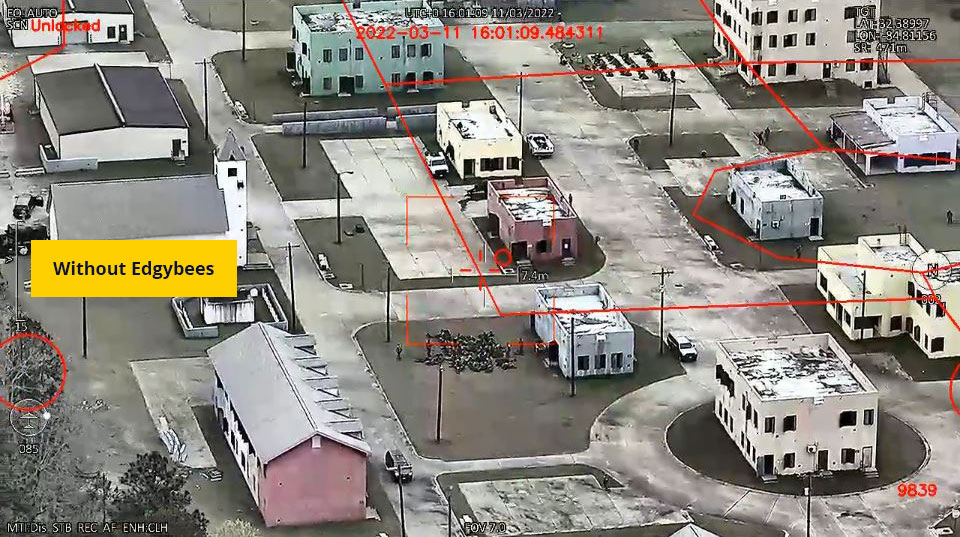
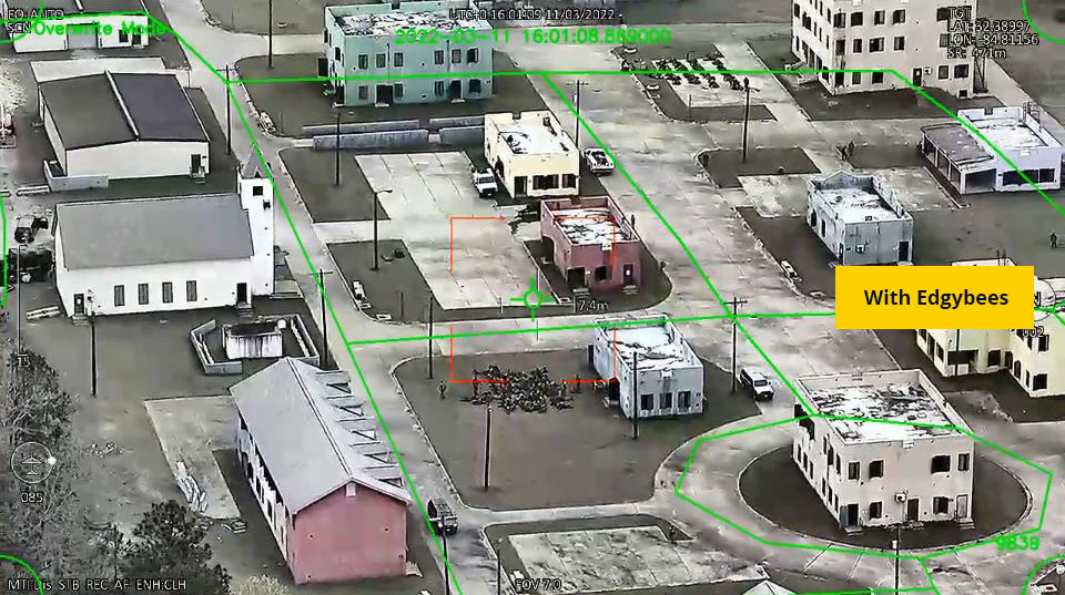
Accurate imagery is critical to understanding your operational environment. Bring immediate situational awareness to the operator and command center by instantly aligning imagery to the real world
Tested in operational environments, Edgybees software has been awarded multiple Department of Defense contracts.
Emergency Responders
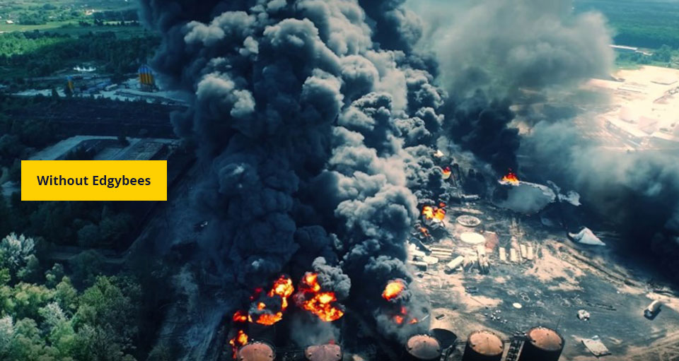
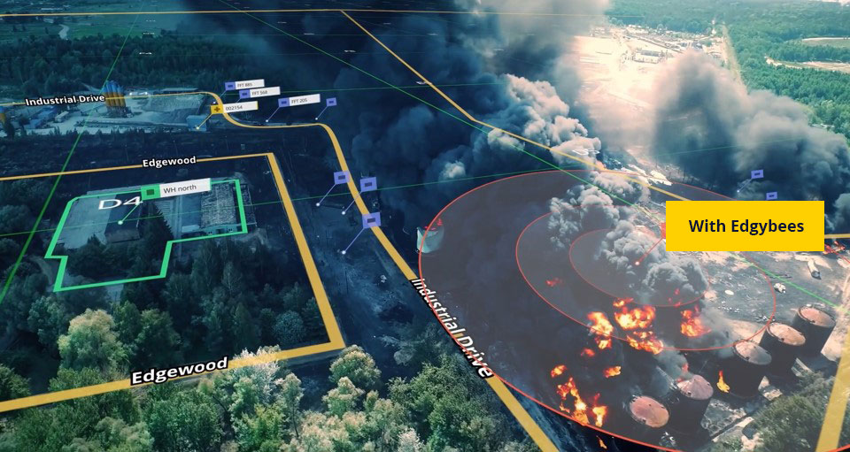
Allow first responders to operate with confidence and speed by providing unprecedented visibility even in the most complex and opaque disaster scene. Execute operations faster by augmenting satellite and motion imagery with accurate, mission-critical data that enables immediate response and fewer errors.
The Edgybees software has been used by first responders in large scale disaster areas, including major hurricanes and wildfires in the US and Australia.
Supporting the Ecosystem Partners
Commercial Imagery Providers
Current satellite imagery can be off by 10s to 100s of meters, requiring manual correction that slows down analytics processes.
Edgybees is teaming with commercial satellite imagery providers to enhance accuracy upstream.
Data Analytics Providers
Maximize the value of your AI solution with accurately aligned images and source data.
Optimize the performance of machine learning algorithms by correctly positioning data in the real world.

We Play Nice with Your Tech Stack
Our software can be integrated with existing systems including BAE, Esri, Hexagon, and others. It is compatible with Amazon Web Services, Microsoft Azure and other cloud service providers for streamlined deployment into your operational environment.