


Could Technology Prevent Overcrowding Disaster?
After 45 people lost their lives when crushed by an oversized crowd at Mount Meron, many are asking how a similar scenario could be prevented.
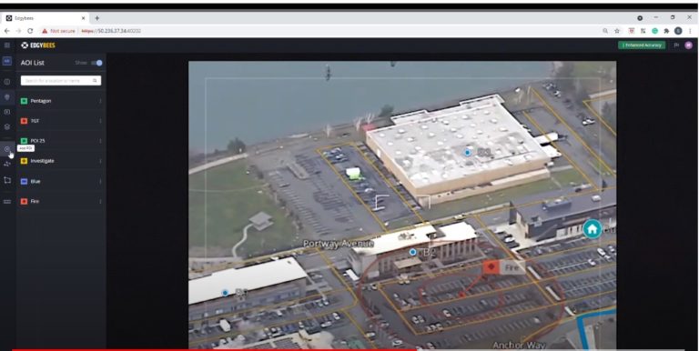
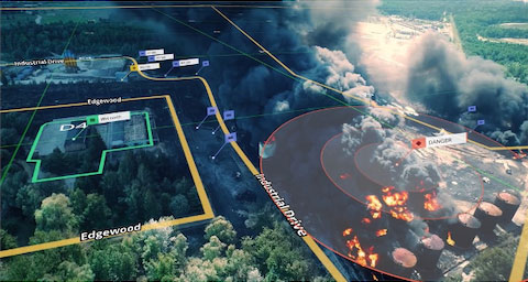
Aerial Video Takes a Big Leap Towards Real-Time Situation Awareness, Powered by Edgybees’ Georegistration Software and HoodTech’s Sensors
Real-time visual augmentation of airborne imagery highlights roads, key landmarks, and other mission-critical data.

Edgybees Closes $9.5M in Series A Funding, Delivers Breakthrough Geo-Mapping Accuracy and Speed for Lifesaving Aerial Video
High precision Georegistration of real-time video feeds enables defense, public safety, and critical infrastructure teams to accomplish lifesaving missions