Unveiling the Power of Georegistration in Commercial Satellite Imagery: A Game-Changer for Businesses
Introduction In the vast realm of satellite imagery, recent advancements have sparked a revolution, opening up new horizons for businesses worldwide. The advent of low-cost satellite imagery services, such as Planet and BlackSky, has transformed the accessibility and availability of high-resolution imagery, empowering businesses of all sizes. Amid this shift, one crucial element stands out: […]
RPC (Rational Polynomial Camera model), The Nitty Gritty
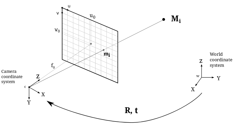
In this blog post, we delve into the nitty-gritty of the RPC camera model. We explore the underlying motivations behind its development, discuss its applications, and provide practical insights into effectively utilizing it. The logic behind it RPC, also known as the Rational Polynomial Camera model, is widely recognized as a standard approach in satellite […]
How to (Finally) Install PyCURL on MacOS

Oren Cohen In this guide, I show you a complete solution on how to install pycurl on macOS. Every few months, as part of one project or another, I find myself installing pycurl on my Macbook and experiencing installation failures. As a Backend Engineer at Edgybees, I have many projects that require pycurl to operate […]
Edgybees Supports Army Expeditionary Warrior Experiments (AEWE) 2022
By Sheffy Glassberg For three weeks in March, Edgybees teammates worked side-by-side with Allied and US Army soldiers and commercial partners during the Army Expeditionary Warrior Experiments (AEWE) 2022. AEWE, which is conducted annually at Fort Benning, Georgia, focuses on testing innovations that enable strategic advantages at the soldier and small unit level. The Army […]
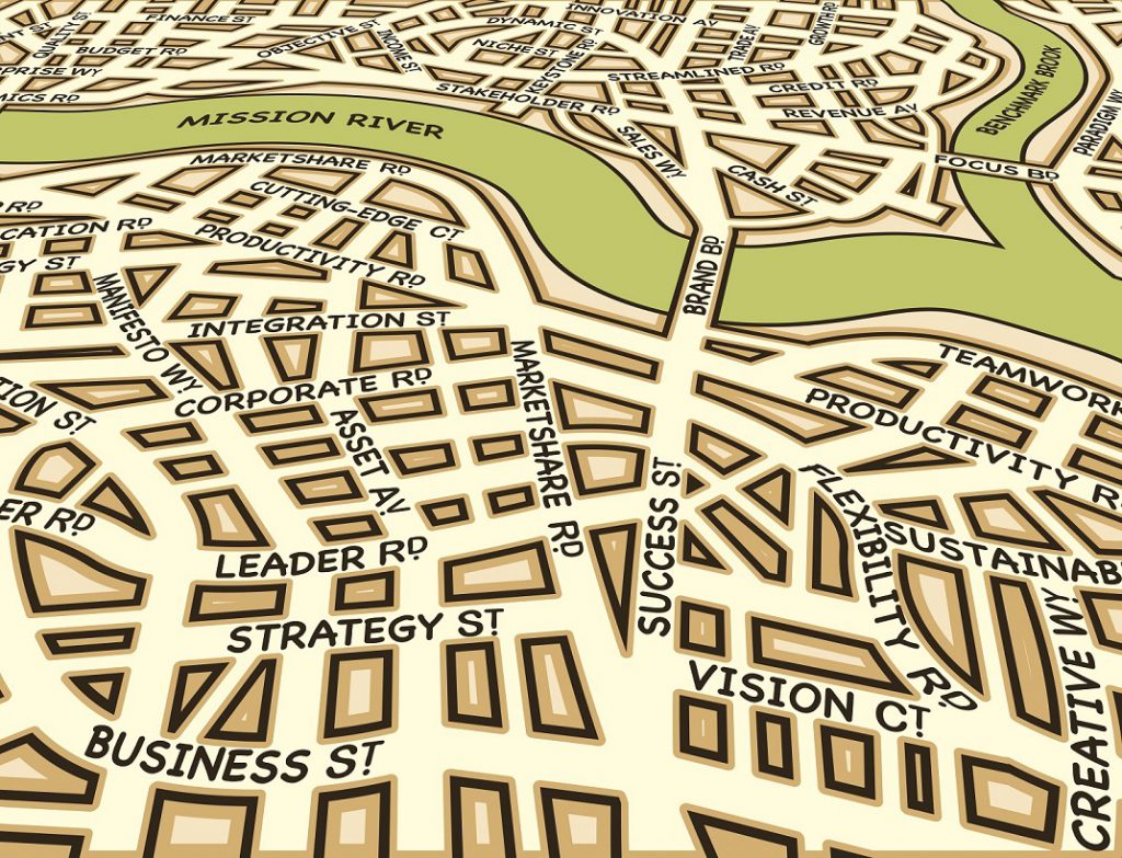
Georegistration: 7 Keys to Situational Awareness
What is Georegistration and why do you need it? Georegistration is the association of a visual object in an image or a video with an accurate geographical location. In other words, it is the meshing of imagery with the geographical coordinates and landmarks that provides the necessary context to the visual. The explosion of video […]
Five Cutting Edge Technologies to Fight Wildfires
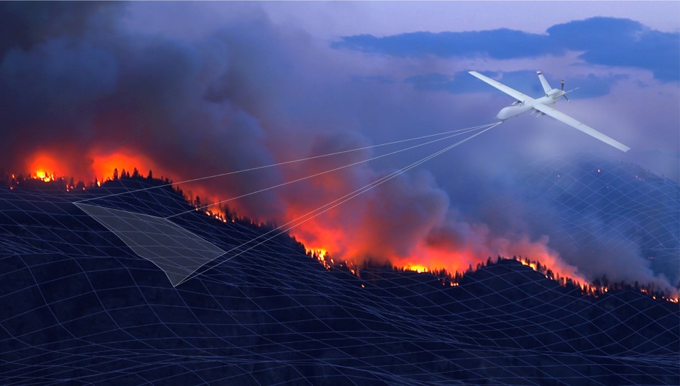
Wildfires are becoming an increasingly threatening challenge. Driven by climate change, fire weather season is now almost 20% longer than it was just four decades ago. In 2020 alone, there were 58,950 wildfires in the US, burning over 10 million acres of land. This caused more than $17 billion in losses and damaged 25,790 structures, […]
#Beesonboard at Hood Tech Aero – Making Aerial Video Actionable in the Fight Against Wildfires

2021 has proven to be one of the worst fire seasons on record for the Pacific Northwest, and it’s not over yet. According to the Insurance Information Institute, the number of wildfires that occurred in the US between January 1 to July 19, 2021 totaled 35,806, compared with 29,008 during that same period in 2020. […]
Edgybees to Showcase High Precision Georegistration of Real-Time Video Feeds at IDEX 2021

We are excited to present the Edgybees Visual Intelligence Platform™ at IDEX 2021, one of the world’s premier defense events. The event will take place February 21 – 25, both online and in person at the Abu Dhabi National Exhibition Centre (ADNEC). The International Defense Exhibition and Conference (IDEX) is the most strategically important tri-service […]
Roadmapping in a Dynamic Environment
A first responder’s guide to roadmapping while the earth is shaking By: Nadav Levy, Senior Product Manager Working within a fast-past environment, as a product manager, has taught me a lot about rocky roads and prioritizing while trying to run fast and deliver quickly. In this article I will attempt to outline three critical steps […]
Augmenting the Command & Control Center
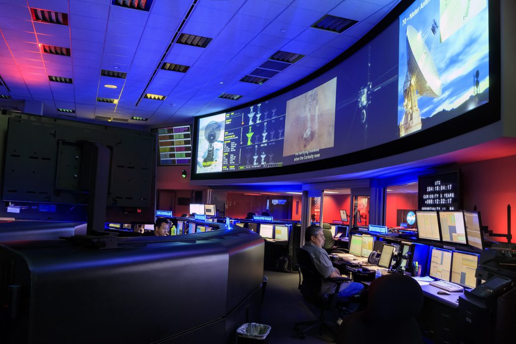
Command & Control Centers, also known as “Operation Center”, are the beating hearts of many organizations and industries. They are equipped by both hardware and software, and used by organizations to manage critical events as they happen. Industries known to be using these include emergency operations, military units, oil & gas and many more. Military […]